Schöne Aussichten im Selketal
Enjoy unique natural scenery
The beauty of the Selketal is that it is surrounded by lushly wooded mountains that are wonderful to hike through. Once you reach the top, you will be rewarded. There are numerous beautiful vantage points on the mountains of the Selketal, offering fantastic views of the lush green valley below. Let your gaze wander and listen to the gentle sounds of the forest. Switching off from everyday life is wonderfully easy in the Selketal.
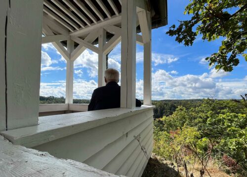

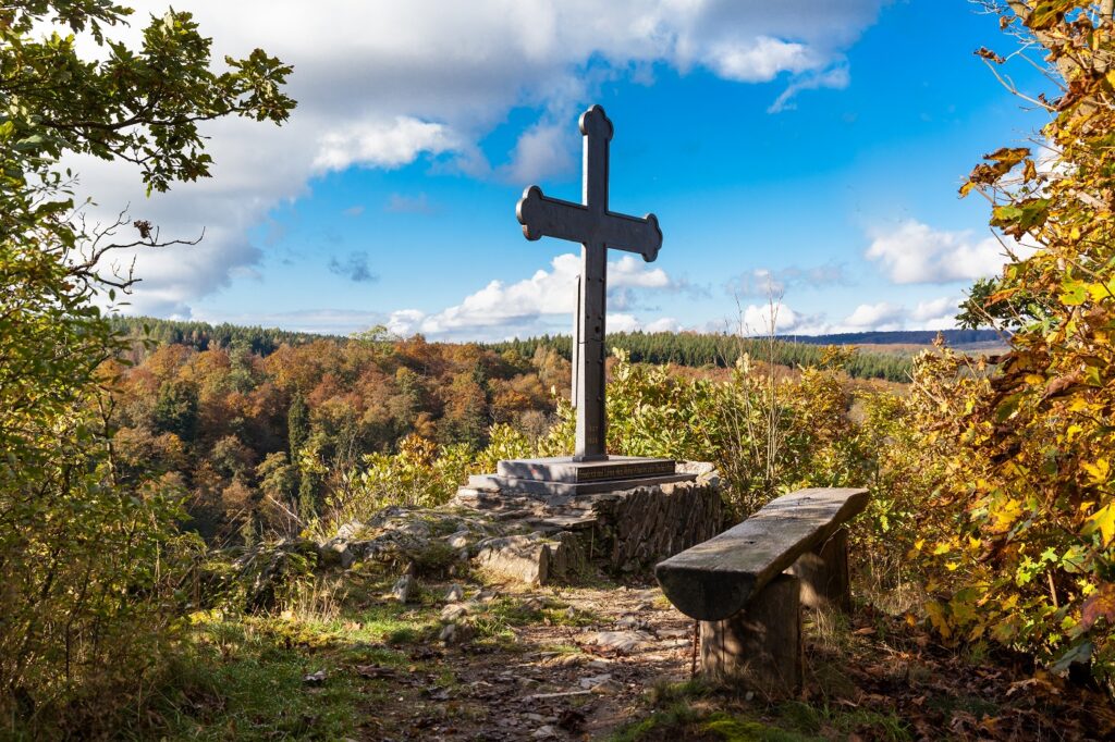
Selkesicht an Der Ackeburg
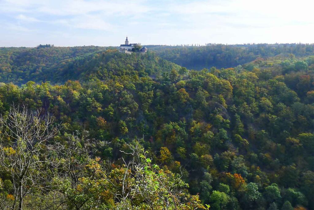
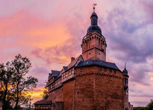
At the Selkesicht viewpoint, you have a magnificent view of Falkenstein Castle and the Selketal below. At this unique location you will find the stamp box 204 of the Harz hiking pin.
WEGBESCHREIBUNG
Start your hike at the forest parking lot above the former lung clinic.
The trail starts on Falkenweg, an asphalt road that runs alongside a residential area and agricultural land. At the fork, continue along the Kohlenschacht path. Now follow the signs to Selkesicht or to the ruins of the Ackeburg castle.
You first reach the ruins of the former Ackeburg castle via a beautiful nature trail. The breathtaking Selkesicht viewpoint awaits you at the end of the trail.
Tip: Stamp hunters take the route via the Old Coal Shaft on the way back, as stamp 180 of the Harz hiking pin.
DID YOU KNOW?
In 2021, the Selkesicht at the Ackeburg was named the “Most Beautiful Stamping Point” of the Harz Hiking Needle.
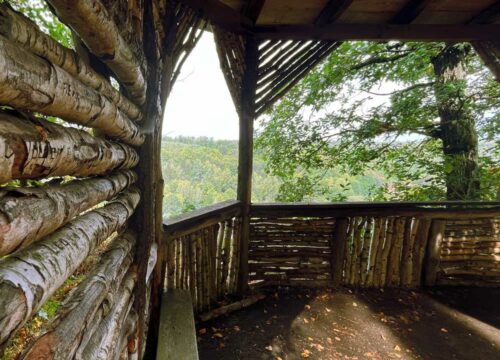
Köthener Hütte
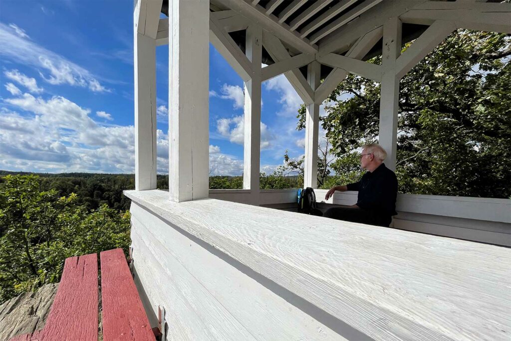
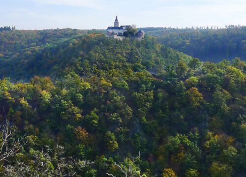
From the Köthener Hütte you have a wonderful view of the deep Selketal and the Ramberg massif. Of course, this uniquely beautiful place is a stamping point for the Harz hiking pin.
WEGBESCHREIBUNG
Start your hike to the Köthener Hütte at the Petruskapelle chapel in Alexisbad. Your almost one-hour hike begins to the right of the chapel. After 100 meters you come to a crossroads and take a sharp left.
Now it’s time to climb! There are around 50 meters of altitude to overcome. After 300 meters, the biggest climb of the route is over and you turn left onto a wider natural path.
The trail marked 34C winds its way through a lush mixed forest with gentle ascents and descents and rewards you at the end with a breathtaking view from the snow-white Köthener Hütte. You have made it! Just let your gaze wander and your mind wander.
The stamp box HWN 195 is located above the Köthener Hütte on a small hill.
YOUR TOUR IN FIGURES
- ROUTE 3.4 km
- DURATION 1 hour
- ascent 85 hm
- DESCENT 25 hm
- HIGHEST POINT 399 meters
- LOWEST POINT 318 meters
DID YOU KNOW?
The Köthener Hütte wasbuilt in 1897 by the Harzklubzweigverein Köthen as a shelter on the so-called Kapellenfelsen, because with its little bell tower and white paintwork it looks like a small forest chapel.
The Ramberg massif, which is considered the highest in the Lower Harz, rises in the distance opposite. Like the Brocken or the Oker granite, it was formed around 300 million years ago.
Birkenhäuschen
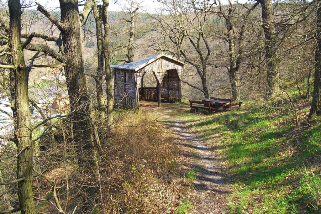
The Birkenhäuschen is a refuge on Schlotheimplatz above the enchanting climatic health resort of Alexisbad. From here you have the most beautiful view of the smallest district of the town of Harzgerode.
WEGBESCHREIBUNG
Start your hike to the birch tree cottage at St. Peter’s Chapel in Alexisbad. To access the almost 500-metre-long hiking trail, cross the bridge over the Selke and turn right at night. A few hundred meters of the way you will be accompanied by the splashing of the Selke, which flows to the right.
The path then splits and you follow the fork to the left. Here the path climbs slightly to the next junction. Continue along the path on the right, which now winds its way through the forest. After around 140 meters, follow the “Selketal-Stieg” signs.
You hike for just under 90 meters on this major long-distance hiking trail in the Selketal. Your destination, the birch hut, is on the right. Next to the shelter, benches invite you to linger and enjoy the view.
YOUR TOUR IN FIGURES
- ROUTE 700 meters
- DURATION 15 minutes
- ascent 52 hm
- DESCENT 22 hm
- HIGHEST POINT 366 meters
- LOWEST POINT 318 meters
DID YOU KNOW?
The Birkenhäuschen refuge was built by the Köthen branch of the Harzklub in 1906.
The Harzklub and its local branch associations take care of the maintenance of the mountain huts, the preservation and construction of hiking trails as well as the preservation of customs and the promotion of nature conservation in the Harz Mountains.
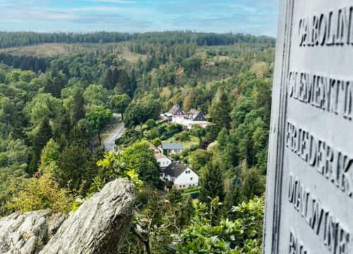
Verlobungsurne
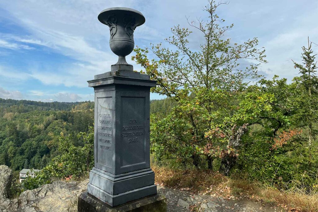
The engagement urn stands on a plateau above Alexisbad on the so-called cliff path. From here, you can enjoy an unobstructed view over the forests of the Selketal below.
WEGBESCHREIBUNG
Start your hike to the engagement urn at St. Peter’s Chapel in Alexisbad. The 1-kilometre route starts on the right after the bridge.
After about 100 meters, the path splits and you follow the junction to the sharp left. From here, the path climbs up to the next crossroads. Take the path on the right, which winds its way through the forest. After around 140 meters, follow the “Selketal-Stieg” signs.
You will soon pass the turn-off to the Birkenhäuschen, which invites you to take a break with a wonderful view of the village of Alexisbad.
Your route then takes you another 300 meters to the rocky plateau where the engagement urn stands. Stamp hunters can look forward to stamp 177 of the Harz hiking pin.
YOUR TOUR IN FIGURES
- ROUTE 1 km
- DURATION 20 minutes
- ascent 53 hm
- DESCENT 2 hm
- HIGHEST POINT 367 m
- LOWEST POINT 318 m
DID YOU KNOW?
Why the name Engagement Urn? The base of the cast art object is adorned with the names of Prince Hugo von Hohenlohe-Oeringen and eleven of his friends, who probably spent many a carefree hour together at the vantage point above Alexisbad in September 1845.
In memory of this, the Württemberg prince had the object made in his foundry and placed on the Habichtstein. This fired the imagination of the villagers, who tongue-in-cheek christened the art object the ‘engagement urn’.
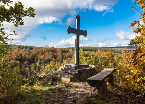
Mägdetrappe
Would you like to see a size 64 footprint? You’ll find it at the Mägedetrappe above the Harzgerode district of Mägdesprung. Legend has it that a giantess jumped over the valley here and left a depression in the rock.
WEGBESCHREIBUNG
Start your walk to the Mädgetrappe from the center of Mägdesprung. Walk out of town in the direction of country road 235. A hiking trail branches off to the right at the bend. Follow this uphill for about 250 meters. Your destination, the rock depression, is located directly on the slope.
The Selketal trail leads directly past the Mägdetrappe. Continue in a south-easterly direction. After about 200 meters, the cast-iron Alexius cross awaits you. Treat yourself to a rest on the bench, the view is fantastic.
YOUR TOUR IN FIGURES
- ROUTE 508 m
- DURATION 15 minutes
- ascent 67 hm
- DESCENT 1 hm
- HIGHEST POINT 346 m
- LOWEST POINT 279 m
DID YOU KNOW?
The Alexius Cross near the Mägdetrappe commemorates Duke Alexius von Anhalt, the founder of the village of Alexisbad.
His daughter, Princess Wilhelmine Luise von Anhalt, and her husband, Prince Frederick of Prussia, had it made in the Mägdesprung iron foundry in 1837 to honor their deceased father.
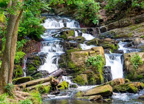
Selkefall
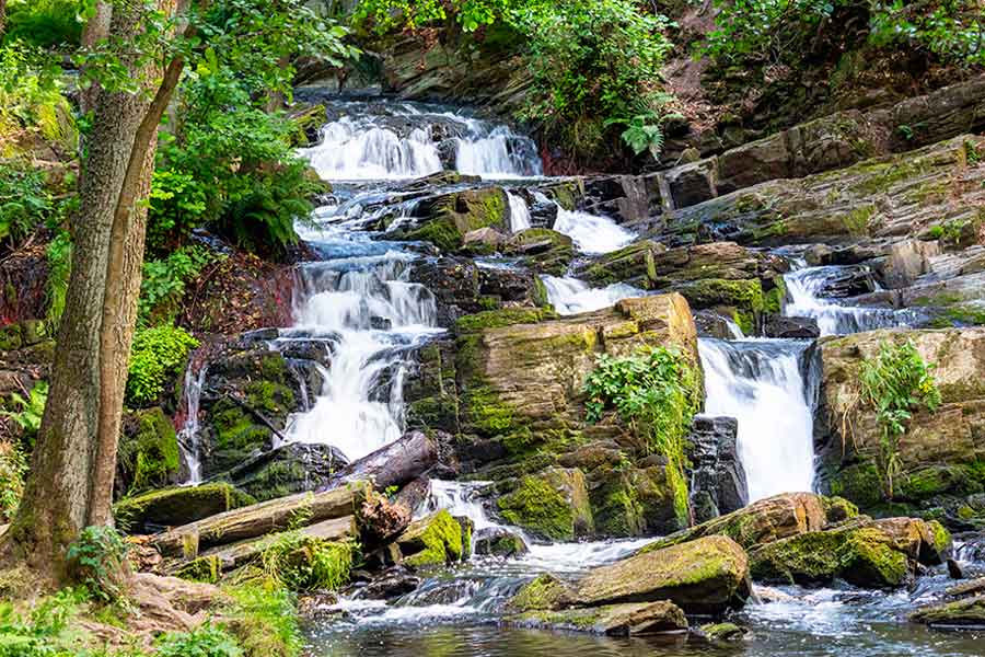
At the Selke Falls, the gentle babbling of the Selke turns into a roar. Treat yourself to a break here on your hike to feel the power of nature and simply unwind.
WEGBESCHREIBUNG
Start your hike to the Selke Falls at the train station in Alexisbad. Follow the B 185 district road through the charming village towards Klostermühle. Treat yourself to a detour to St. Peter’s Chapel from the early 19th century, whose yellow wooden façade shimmers through the trees from afar.
From here, walk along the forest path, the Wilhelm von Kügelgen promenade, while the Selke accompanies you on the left. Follow the course of the river to the end of the village. Cross the district road here onto the Horst-Schöne-Weg.
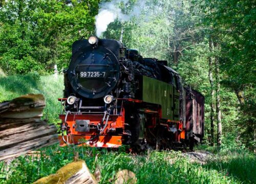
Now the tracks of the Selketalbahn running to the right of the path show you the direction to the Friedenstal T-junction. You will have to cross the tracks from time to time. At the junction, take the sharp right fork. The path meanders between the Selkelauf and the tracks to your destination, the Selke Falls.
YOUR TOUR IN FIGURES
- ROUTE 3.6 km
- DURATION 60 minutes
- ascent 60 hm
DID YOU KNOW?
Even though the Selke Falls are located in the “Upper Selketal” nature reserve, they are not a natural waterfall, but a man-made one. The water plunges almost four meters into the depths in several cascades.
The Selke Falls were created in 1830 together with the Carls Pond to supply the ironworks in Mägdesprung with process water. While the pond was destroyed by a flood in 1955, the Selke Falls are still one of the scenic highlights in the Selketal and a popular photo motif at any time of year.