Unterwegs auf dem Selketal-Stieg
Reward yourself with picturesque views and stamps
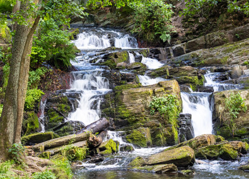
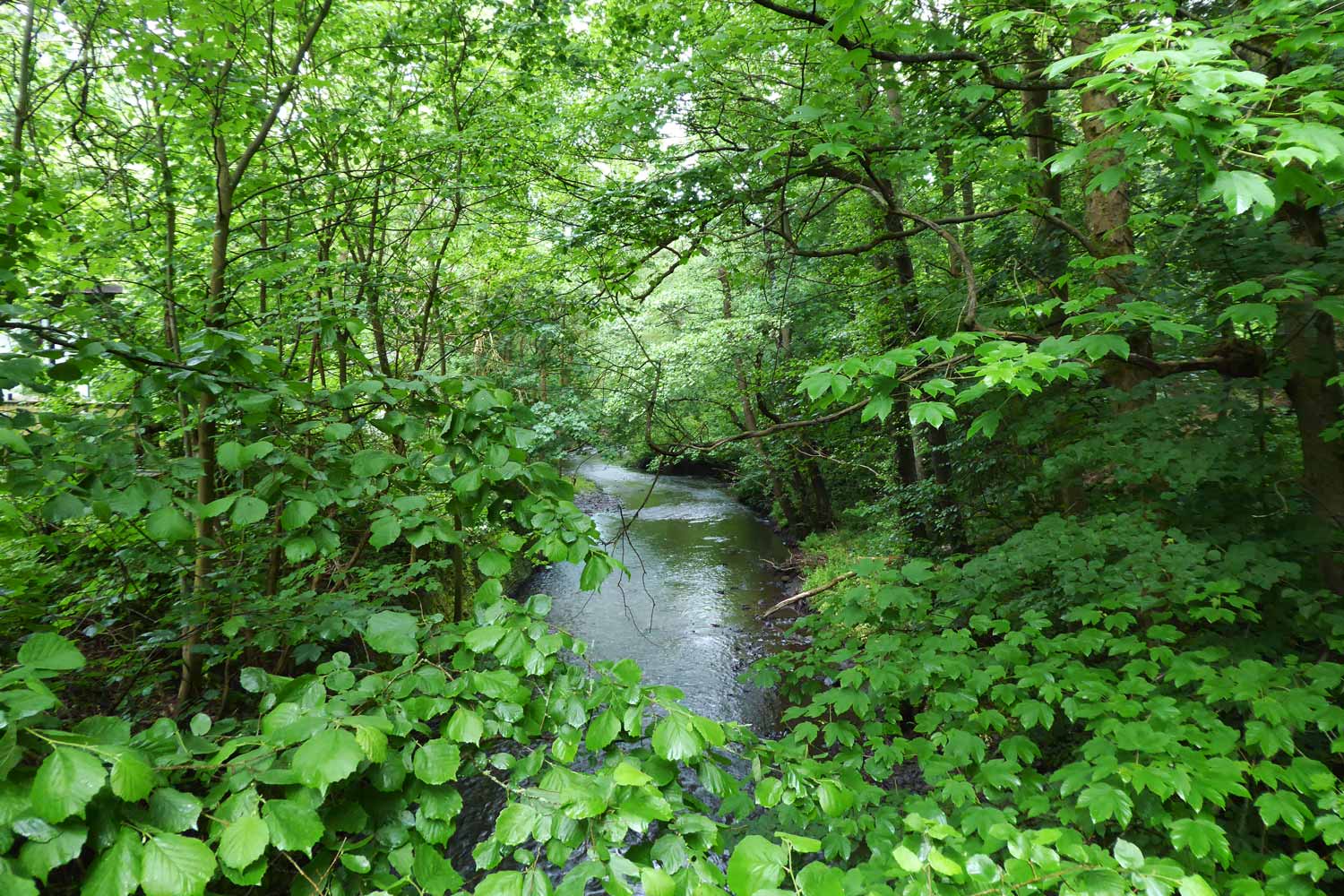
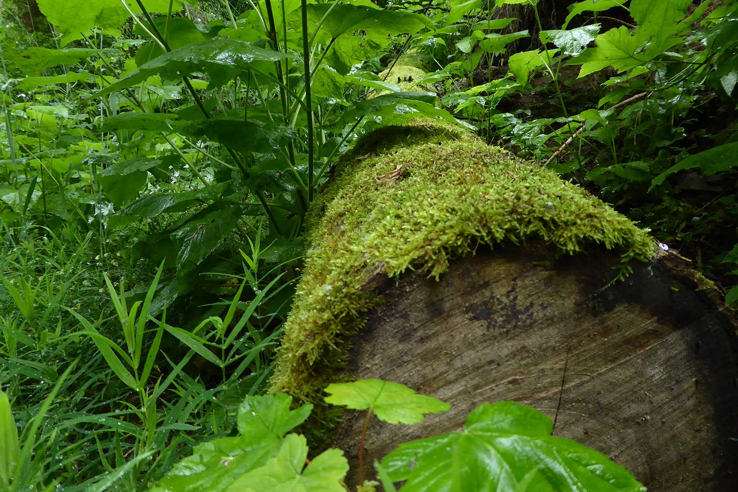
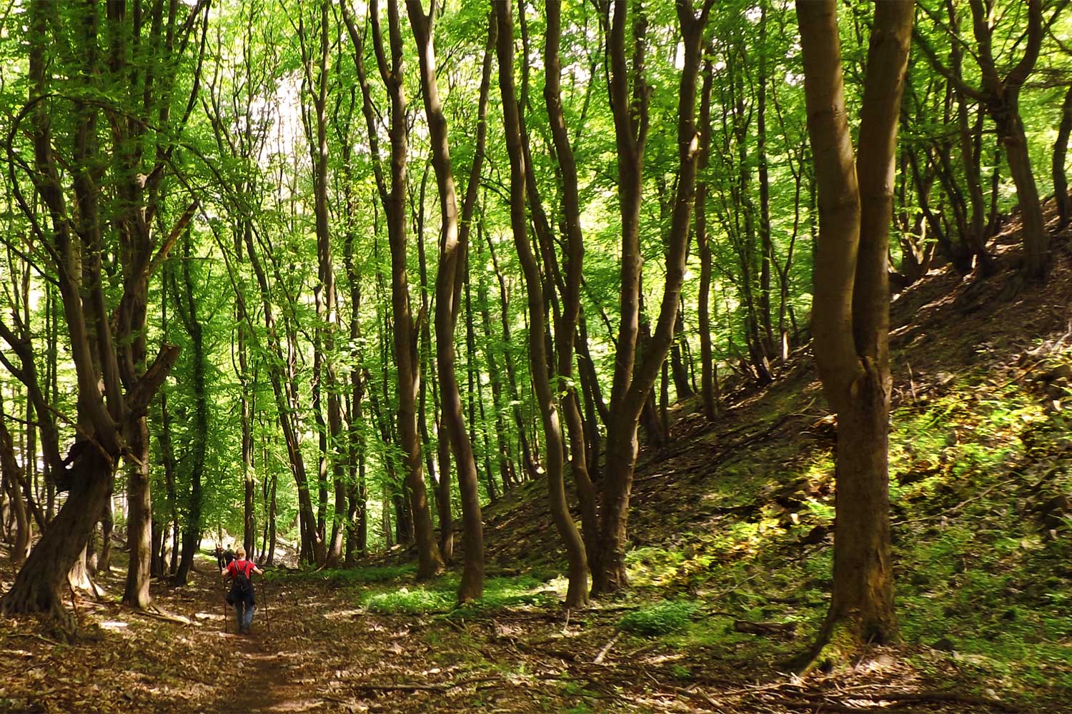
The Harz Selketal Trail is a long-distance hiking trail almost 75 kilometers long that runs from Stiege via Güntersberge, Straßberg, Silberhütte, Alexisbad, Mägdesprung, Meisdorf, Ballenstedt, Gernrode, Bad Suderode to the UNSECO World Heritage town of Quedlinburg. On the Selketal climb Hike through pristine nature, past gnarled tree roots and imposing rocks. The scenery becomes fairytale-like as the hiking trail winds its way over hilltops, the view of the enchanting valley opens up high above and the magnificent Falkenstein Castle towers between the treetops.
Falkenstein Castle is one of 17 stamping points of the hiking badge Harz Hiking Badge “Selketal-Stieg” – all at places steeped in history and beautiful viewpoints situated. For a filled stamp booklet, you can use our special regional badge in the form of a Kingfisher take home with them as well as numerous memories of unforgettable hiking moments in the pristine protected nature of the Selke Valley. The long-distance hiking trail is easy to master in 4 to 6 stages – provided you can tear yourself away from the indescribably beautiful views along the way.
Der Selketal-Stieg im Überblick
- Start: train station in Stiege
- Destination: Carl-Ritter-Platz, Quedlinburg
- Route length: 74.87 km
- Difficulty level: medium
Selketal-Stieg in 6 Etappen
Selketal-Stieg in 4 Etappen
Length: 24 km
Duration: approx. 6 hours
Height difference: approx. 160 m
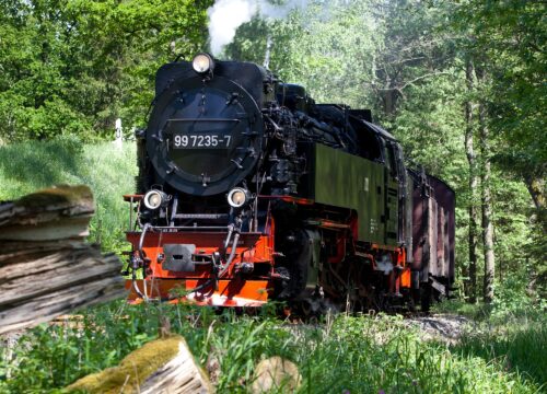
Your hike on the Selketal Trail begins at the train station in Stiege. First you follow the Hassel river uphill until you come to the Selke. At this point, you reach the highest point of the route at 500 meters. The path takes you past the church in Selkenfelde and the former Albrechthaus sanatorium. After passing the Selkebahn Friedrichshöhe stop, you walk parallel to the railroad tracks through the “Upper Selketal” nature reserve to the mill pond in Güntersberg. Here you can visit the ruins of Güntersburg Castle on the Kohlberg. You then follow the course of the Selke to Straßberg, where you can take a break and explore the visitor mine. The route continues past the Rinkemühle mill and the Pochwerk, one of the most important silver mines in the Lower Harz region. On the last section of the route, you walk past the “Unterharzer Waldhof” forest information center and reach Silberhütte. After a final ascent of 400 meters, you finally reach Alexisbad.
Length: 22.5 km
Duration: approx. 6 hours
Height difference: approx. 130 m
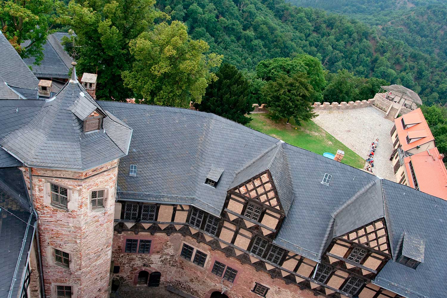
Your hike begins in Alexisbad and runs parallel to the Selketal Railway as far as the Habichtstein. The cliff path then leads you into the picturesque parkland of the “Alexis-Bad”. Here you walk past the engagement urn, the birch house and the artwork “Eisenhütte unterm Mägdesprung”. After leaving the cliff path, you will reach the Luisentempel. From there, you first follow the Pionierweg and then change to the Hohlweg, where you can discover medieval tracks in the rock. Back on the Pionierweg, you cross a rock tunnel, behind which the Köthener Hütte is located on the rock of the Schalkenburg. Continue along the cliff path to Mägdesprung. Here you can visit the Carlswerk industrial museum. The hiking trail takes you downstream along the banks of the Selke to the narrowest part of the Selketal, the “Lampe”. You then hike through former smelting villages from Mägdesprung to the Selkemühle mill. From here, you can take a detour to the ruins of Anhalt Castle, which was built by Albrecht the Bear. The trail continues through the nature reserve with its beautiful landscape to Falkenstein Castle, the best-preserved medieval castle in the Harz Mountains. It was here that Eike von Repgow wrote the Sachsenspiegel, the oldest German law book, between 1221 and 1235. The last part of your hike takes you along the Selke river to Meisdorf, where you can visit a baroque castle and park, which now houses a hotel.
LENGTH: 17 km
DURATION: approx. 3.5 hours
HIGH DISTANCE: approx. 330 m
Your hike begins in Meisdorf and takes you in a westerly direction to Ballenstedt. First you cross the Petersberger Trift and pass the golf course of the Parkhotel Schloss Meisdorf. The route continues past Eckartsberg, from where you can enjoy an impressive view of a historic coal tip. Shortly afterwards, you will reach the foothills of the Teufelsmauer, the sandstone cliffs of the Gegensteine. Your route continues to the picturesque town of Ballenstedt, where you come across the Fürstenweg, which you follow to Gernrode. After leaving Gernrode behind you, you pass Roseburg Castle and the Osterteich pond and cross the route of the Selketal Railway. Via the Schwesternweg and Herrenbergsweg, you have the opportunity to take a detour to the collegiate church of St. Cyriakus, one of the oldest churches in Northern Europe with over 1000 years of history. Finally, you reach Bad Suderode, the destination of this stage of your hike, via the Panorama Trail.
Length: 9 km
Duration: approx. 2.5 hours
Height difference: approx. 80 m
Your hike on this stage of the Selketal-Stieg begins in Bad Suderode. You pass the Bückemühle mill and follow the path along the Quarmbach stream. The path continues past the Dreibogenbrücke bridge to Quarmbeck, where you have an impressive view of the Teufelsmauer wall, above whose sandstone cliffs the Quedlinburg collegiate church towers. You then cross the Bode over the Schafbrücke bridge and walk through the English-style Brühlpark. Finally, you follow the hiking trail to the UNESCO World Heritage town of Quedlinburg, the destination of this stage.